The natural notion that commerce will follow the people depends in large part on whether the people can actually get there in the first place. In 1810, a useful highway was one that a wagon could negotiate during a light rain.
An acceptable rut.
The first route to Fairfield was a clandestine trace from an area near the town of Mt. Carmel in Whitewater Township to an area somewhere near where Templeton's Creek flowed into the East Fork of the Whitewater River -- about midway between Brookville and Fairfield.
The roads that came into being after that generally followed the river on both sides. Commerce connected to Cincinnati. As the population grew and the demand for goods and services increased, so came the need for transportation.
The railroad was still a concept.
The Indiana Magazine of History, under the direction of Indiana University's history department, explains the dilemma of the 1820s:
"The chief drawback in the southeast was poor transportation. Cincinnati was the principal market, but Whitewater farmers could send their products to town only by laborious haulage over miserable roads. En route to the Ohio city from Richmond, about 65 miles, or from Brookville, 43 miles, a four-horse wagon bumped and lurched for several days, and freightage was $10 a ton or more. Foodstuffs and other necessities came into the valley by the same hard method. Cattle and hogs, herded by drovers, plodded on foot, lost weight and value on the way, mired down, died. Sorely needed was a better highway to tap the agricultural wealth of this Whitewater country."
What emerged was the long, tedious and politically sensitive movement toward creation of the canal system that did, after years of work, produce a useful economy. The canal benefited Fairfield in a marginal way. It was still 8 miles to Brookville.
Uneven, scarcely functional roads linked Fairfield to Brookville, where merchandise met up with the canal. The road on the east side of the river was a toll road. I have been unable to determine the details of how the toll road system worked. One would imagine that virtually none of the toll income went toward infrastructure improvements.
 The toll booth was just south of town. Later came the state highway. It is shown circled on the map.
SR 101 was a project of the Depression-era WPA. It connected Brookville with Liberty with a modern concrete slab, one that was relocated in 1969 when the dam project forced the old road to close.
Prior to the SR101 work in 1934, the main road to Fairfield was on the west side of the river, where it wound around carelessly and hooked into Fairfield-Blooming Grove Road just west of the covered bridge. That road ran into town and was the main street, going northward into Union County where it turned and went back across the river into Dunlapsville.
 When SR101 was built, the Dunlapsville Road ceased to exist and came to a grassy halt a few hundred yards north of Sims Cemetery.
Other roads into Fairfield came from Bath to the east. Today, Bath Road follows its western original course, ending abruptly in some weeds that are a few hundred feet from a golf course green.
Causeway Road that goes west to Blooming Grove, ends at the new SR101. Hanna Creek Landing is located at the end of old SR101.
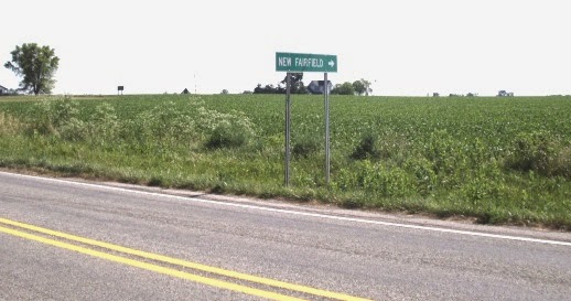
Top picture: From SR1 in Blooming Grove, go east at the flasher to New Fairfield.
Bottom picture: Go anywhere you want so long as you yell 'fore'! This is Bath Road.
The map is from an 1882 Atlas of Indiana.
No comments:
Post a Comment